 PlaceBee
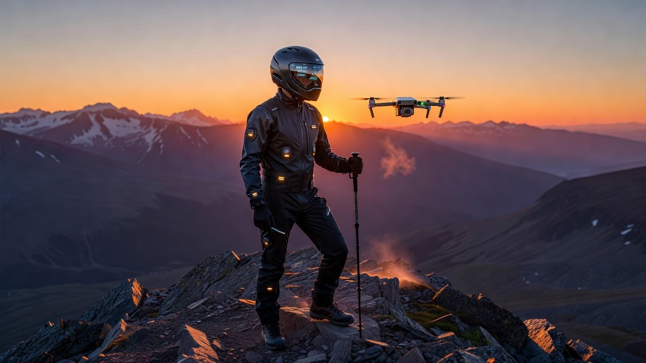
Introduction to Wearable Tech in 2026 Extreme Hiking
Extreme hiking in remote terrains demands more than physical endurance. In 2026, wearable technology combines biometrics, AI navigation, and drone support to reduce risks and boost performance. Athletes now rely on real-time data from devices that monitor heart rate, oxygen levels, and environmental hazards during high-stakes adventures. These innovations allow explorers to push boundaries while maintaining a safety net previously unavailable in isolated wilderness areas.
This evolution transforms thrill travel by providing predictive alerts and seamless connectivity. Hikers venturing into isolated mountains or canyons benefit from integrated systems that anticipate fatigue or weather shifts before they become dangerous. The result is a more informed and prepared approach to adventure that blends human skill with machine intelligence.
Key Features of Biometric Wearables for Hikers
Modern biometric wearables track vital signs with precision. Sensors measure ECG, SpO2, and core temperature, sending data to companion apps. Advanced models include fall detection and hydration reminders tailored for multi-day treks. These tools also log sleep patterns and recovery metrics overnight, helping athletes optimize rest between demanding days on the trail.
These devices integrate with smart clothing to analyze muscle strain and gait patterns. In 2026, AI algorithms predict overexertion by comparing current metrics against historical performance data from similar expeditions. Hikers receive personalized recommendations such as pace adjustments or rest stops based on accumulated fatigue scores.
Smart Helmets and GPS-Enabled Suits
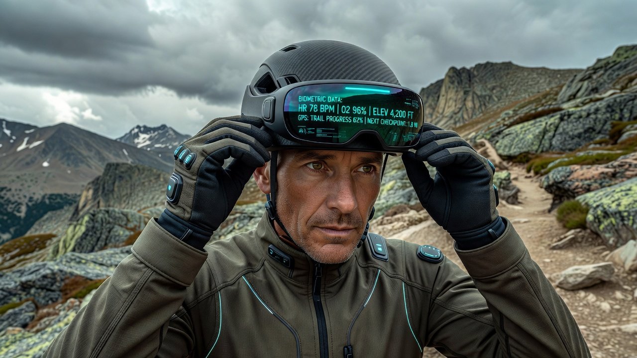
Smart helmets feature built-in cameras, impact sensors, and heads-up displays for navigation overlays. They connect to GPS suits that embed location beacons and thermal regulation layers, essential for extreme cold or heat exposure. The suits also incorporate flexible solar panels that extend battery life during long expeditions.
GPS suits provide 360-degree positioning even in deep canyons where satellite signals weaken. Combined with biometric feedback, they alert users to route deviations or physiological stress in real time. This combination creates a closed-loop system where physical data directly influences navigation decisions.
Integrating AI Navigation with Wearables
AI navigation systems analyze terrain data from drones and satellite feeds. Hikers sync wearables to receive dynamic route adjustments based on live conditions like avalanche risk or trail erosion. The AI processes inputs from multiple sources to generate safer alternatives within seconds of detecting changes.
Setup involves pairing devices via Bluetooth or satellite links. Users upload planned itineraries, allowing the AI to suggest alternatives if biometric readings indicate rising fatigue levels. Integration with weather models from authoritative sources further refines these suggestions for maximum safety.
Real Athlete Case Studies from Remote Adventures
Professional hiker Elena Vargas completed a drone-supported trek through Patagonia in early 2026. Her biometric vest detected early signs of altitude sickness, prompting an immediate descent guided by AI alerts. The system coordinated with a support drone for emergency supply delivery, allowing her to complete the route safely after a brief recovery period.
Another example comes from Marcus Hale, who used a smart helmet during an Alaskan expedition. GPS suit data helped avoid a crevasse field after AI cross-referenced weather patterns and personal vitals, preventing a potential accident. A third case involves trail runner Sophia Reyes in the Andes, where her wearable network triggered an evacuation request after detecting sudden temperature drops combined with elevated heart rate.
Training Routines Enhanced by Wearable Data
Effective training starts with baseline biometric testing. Athletes simulate extreme conditions using wearables to monitor recovery times and optimize interval sessions. Data from these sessions reveals individual thresholds for heat tolerance and oxygen efficiency, guiding customized programs.
- Begin with weekly endurance hikes tracking heart rate variability to build aerobic capacity gradually.
- Incorporate strength drills focused on core stability, reviewed via suit sensors that flag imbalances in real time.
- Review AI-generated reports weekly to adjust intensity and prevent injury before it occurs.
- Practice drone coordination drills in controlled environments to master emergency response sequences.
- Include altitude simulation sessions using supplemental data from wearables to prepare for high-elevation challenges.
Risk Mitigation Strategies with 2026 Tech
Layered safety protocols combine device alerts with traditional skills. Always carry redundant power sources and manual maps alongside AI tools. Establish check-in schedules with support teams using suit beacons that transmit location every 30 minutes regardless of connectivity.
Key strategies include pre-trip terrain analysis via AI apps and post-hike data reviews to refine future plans. Integration with National Park Service resources ensures compliance with local regulations in protected areas. Additional layers involve sharing live feeds with trusted contacts and setting geofenced boundaries that trigger automatic notifications if crossed unexpectedly.
Comparison of Top Wearable Products
Leading options in 2026 include the Summit BioVest, which excels in multi-metric tracking and long battery endurance, versus the Apex SmartHelmet focused on impact protection and visual overlays. The TrailGuard GPS Suit offers superior environmental adaptation and solar charging compared to basic models that lack advanced thermal features.
Users should evaluate battery life, connectivity range, and app ecosystems before purchase. Cross-compatibility with drone platforms adds significant value for remote treks. The BioVest leads in biometric depth while the GPS Suit prioritizes location accuracy in signal-poor zones.
Practical Setup Steps for AI-Assisted Gear
- Charge all devices fully and update firmware via manufacturer apps to ensure the latest safety protocols are active.
- Pair wearables with your smartphone or dedicated AI hub using secure protocols and test connectivity before departure.
- Calibrate sensors during a short test hike to establish personal baselines that improve alert accuracy over time.
- Upload route plans and enable drone sync for live monitoring throughout the journey.
- Test emergency protocols, including beacon activation and alert sharing with your support network.
- Review all data logs after each training session to identify patterns and refine usage habits.
2026-Specific Tech Advancements
Recent developments include improved AI predictive models that incorporate global expedition databases and enhanced mesh networking between multiple wearables on group hikes. These advancements allow for collective risk assessment where one hiker's data benefits the entire team through shared alerts.
Frequently Asked Questions
How do I choose the right wearable for my skill level?
Assess your typical trip duration and terrain. Beginners benefit from basic biometric bands, while experts need full GPS suits with AI features for complex environments.
Can these devices work without cell service?
Yes, most 2026 models rely on satellite and drone mesh networks for connectivity in remote zones where traditional signals fail.
What training is required before using AI navigation?
Start with manufacturer tutorials and practice in familiar areas to build confidence in interpreting alerts and overriding suggestions when needed.
How often should I update device firmware?
Check for updates monthly or before major expeditions to incorporate the latest safety algorithms and bug fixes released by developers.
Conclusion
Wearable tech in 2026 elevates extreme hiking safety through precise monitoring and intelligent assistance. By combining biometric insights, smart helmets, and GPS integration, adventurers can tackle challenging routes with greater confidence. Embrace these tools alongside solid preparation for unforgettable, secure experiences. For broader outdoor guidelines, consult Centers for Disease Control and Prevention resources on physical activity in wilderness settings and National Oceanic and Atmospheric Administration weather data for trip planning.

No comments yet. Be the first!