 PlaceBee

Introduction: Unlocking Authentic City Exploration in 2026
Travelers seeking genuine experiences are turning to advanced public transit apps to bypass tourist crowds and reach hidden gems. In 2026, these tools combine real-time data, local insights, and seamless ticketing to make off-peak exploration accessible and budget-friendly. This guide shows you how to master apps for Tokyo, Paris, and New York City while incorporating walking strategies and social listening features. Whether you are a first-time visitor or a seasoned explorer, understanding these platforms transforms how you navigate urban landscapes and discover authentic neighborhoods that guidebooks often overlook.
Core Features of Leading 2026 Transit Apps
Modern apps integrate route planning with crowd predictions and offline capabilities. Tokyo's apps emphasize punctuality and multilingual support. Paris Metro tools focus on multimodal connections, while NYC MTA apps excel in real-time alerts for subway and bus lines. Key functionalities include predictive arrival estimates based on historical patterns, integration with local event calendars, and user-generated content layers that highlight emerging spots reported by residents. Social listening features scan public posts and reviews to flag rising trends in lesser-known districts, allowing travelers to adjust plans dynamically.
- Real-time routing with predictive arrival times and delay notifications
- Local research layers including user reviews, photo uploads, and event calendars
- Social listening for trending neighborhood spots and crowd density alerts
- Offline map downloads covering entire metro systems and walking paths
Understanding Real-Time Routing and Local Research Techniques
Real-time routing goes beyond basic directions by factoring in live traffic, service changes, and even weather impacts on outdoor connections. Local research techniques embedded in these apps pull from municipal databases and community forums to suggest routes that pass near artisan workshops, quiet parks, or seasonal markets. For example, filtering for off-peak travel reveals paths that avoid school dismissal times or lunch rushes, opening doors to serene experiences in bustling cities.
Detailed Breakdown: Tokyo Transit Apps
Tokyo's ecosystem, including tools from Tokyo Metro and JR East, provides hyper-accurate schedules and English interfaces. Travelers can plan journeys to hidden gems like the quiet temples in Yanaka or the back alleys of Shimokitazawa. Integration with IC cards allows instant transfers between rail, subway, and buses without additional purchases.
Detailed Breakdown: Paris Metro Tools
Paris apps such as those from RATP offer extensive multimodal planning across metro, RER, and trams. They excel at suggesting routes to lesser-visited arrondissements where local bakeries and street art thrive. Offline modes prove invaluable during peak tourist seasons when network congestion spikes.
Detailed Breakdown: NYC MTA Apps
The MTA app stands out for its robust alerts and contactless payment options. Users can discover hidden spots in Brooklyn or Queens by combining subway lines with short bus hops, then layering in social listening to identify pop-up food stalls or community gardens popular with locals.
Case Study: Kyoto Off-Peak Discovery
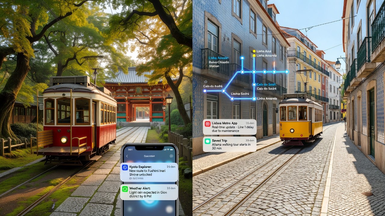
Start in Kyoto's historic districts by using integrated transit apps for early morning temple visits. Follow step-by-step routing from Kyoto Station to lesser-known shrines like those in the Higashiyama area during off-peak hours. Begin by downloading the app and selecting a departure after 9 AM to miss commuter rushes. The system recommends bus line 206 followed by a 12-minute walk through residential streets to reach secluded gardens. This approach reveals traditional machiya houses and small tea houses that remain untouched by large tour groups.
Case Study: Lisbon Hidden Neighborhoods
In Lisbon, apps help navigate the city's hilly terrain to reach Alfama's quiet alleys and Belém's lesser-visited viewpoints. Use ticket integration for tram and metro combos, then apply offline maps when signal drops in narrow streets. A sample itinerary starts at Rossio Square, transfers to the 28E tram route during mid-morning, and ends with a gentle uphill walk to viewpoints overlooking the Tagus River away from the main cruise terminal crowds.
Comparing Ticket Integration and Offline Modes Across Cities
Tokyo systems offer unified IC cards with seamless transfers across private and public operators. Paris provides Navigo passes for regional coverage including airport links. NYC MTA supports contactless payments across subways, buses, and even some ferries. Offline modes ensure navigation continues without data, a critical feature for international travelers who encounter roaming limitations. Each system balances convenience with accessibility, though Tokyo leads in precision timing while Paris offers broader regional reach.
Walking Strategies and Social Listening Features in Depth
Pair transit stops with 15-20 minute walking loops to uncover local cafes and street art. Enable social listening in apps to monitor real-user posts about emerging spots, helping you time visits before they gain popularity. Combine this with built-in safety filters that highlight well-lit paths and report recent user feedback on neighborhood conditions. These strategies encourage deeper immersion while maintaining flexibility for spontaneous discoveries.
Safety and Crowd-Avoidance Tips
Travel during shoulder hours such as mid-morning or early afternoon. Share live locations with companions through app sharing tools. Review safety ratings and recent incident reports within apps before committing to routes. Avoid peak commuter surges by checking predicted density maps updated hourly. Additional precautions include carrying a portable charger for extended offline use and familiarizing yourself with local emergency numbers displayed in the app interface.
Practical Step-by-Step Examples for First-Time Users
- Download the relevant city app from official stores and enable offline map downloads for your target neighborhoods.
- Input a hidden gem address and filter results for off-peak departures between 10 AM and 3 PM.
- Cross-reference suggestions with local forums integrated in the app for recent user updates on construction or events.
- Plan return routes using integrated ticketing options to minimize transfers.
- Activate social listening alerts to receive notifications about nearby pop-up attractions reported by residents.
- Review walking directions and safety notes, then begin your journey with confidence.
Conclusion: Mastering Transit for Pro-Level Exploration
By combining these apps with thoughtful planning, travelers achieve authentic, budget-friendly adventures that feel truly local. The blend of technology and human insight turns ordinary commutes into gateways for discovery.
FAQ: App Comparisons and Ethical Local Engagement Practices
How do Tokyo apps compare to Paris tools? Tokyo prioritizes precision and punctuality while Paris emphasizes seamless multimodal connectivity across a wider region. What is ethical engagement? Support small businesses by purchasing from independent vendors, respect quiet residential zones, and leave no trace by following local waste guidelines. Always verify current policies on official transit sites such as MTA, RATP, or Tokyo Metro before travel. How can I avoid overtourism? Use crowd-avoidance filters and visit during shoulder seasons to distribute impact evenly across neighborhoods.
No comments yet. Be the first!