 PlaceBee
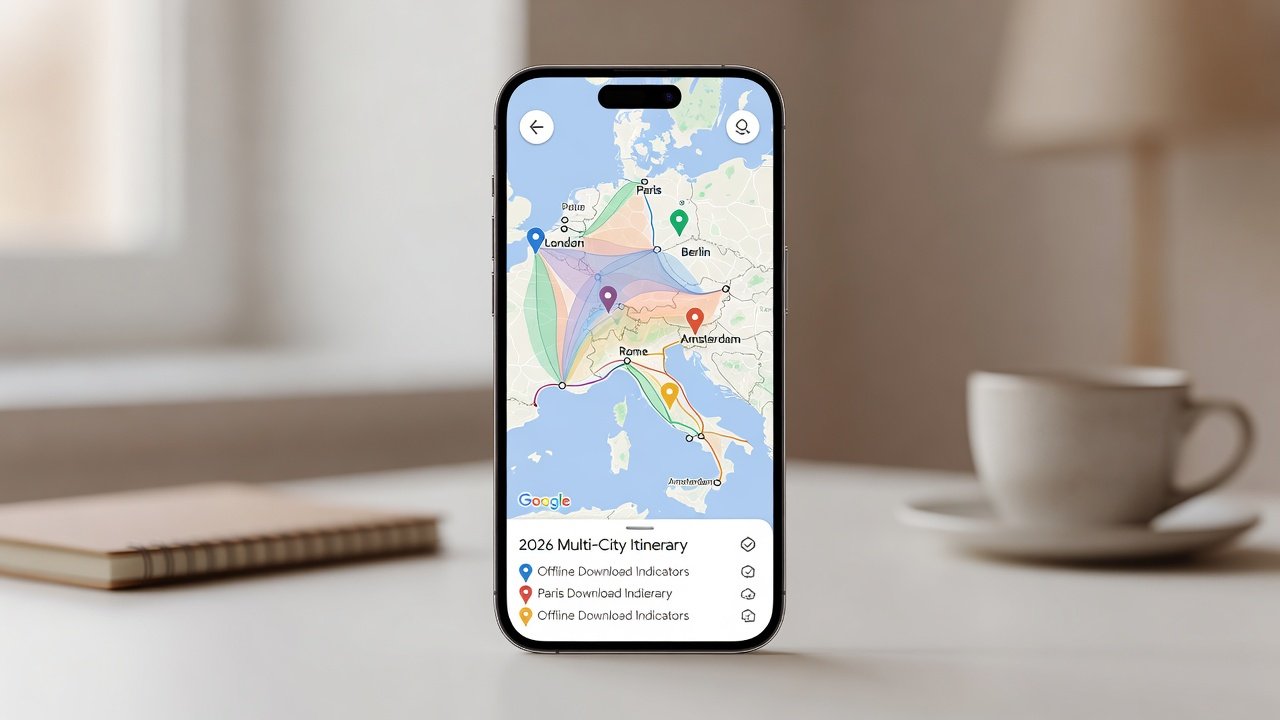
Introduction to Google Maps for 2026 Travel Planning
Planning a multi-stop journey in 2026 requires precision, especially when coordinating flights, hotels, public transport, and driving segments across different countries. Google Maps offers powerful tools like layers, custom pins, and offline features that help travelers build accurate day-by-day itineraries. This comprehensive guide walks through every step to optimize routes between cities while adding realistic buffer times for delays, weather impacts, and unexpected events. Whether you are a first-time user or an experienced traveler, mastering these features ensures smoother logistics and more enjoyable trips.
Understanding Google Maps Layers for Itinerary Building
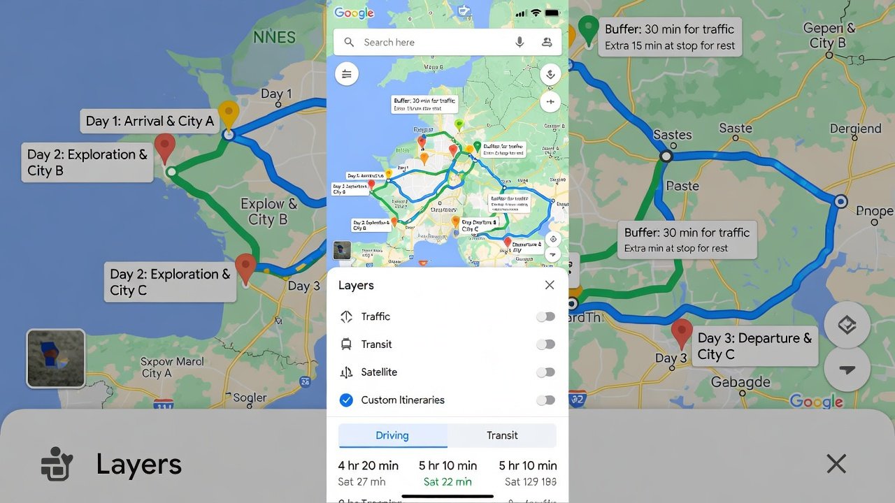
Layers in Google Maps allow you to overlay different data sets such as traffic, transit, and terrain to gain deeper insights. Start by opening the app or web version and tapping the layers icon in the top right corner. Enable the Transit layer to see bus, train, and ferry schedules with real-time updates where available. Then add the Traffic layer to identify peak congestion times and plan departures accordingly. For 2026 trips, combine these with the satellite view for visual confirmation of landmarks near your hotel bookings and walking paths. The terrain layer proves useful in mountainous regions to anticipate elevation changes that affect travel times. Experiment with the bicycling layer if your itinerary includes bike rentals between cities. These layered views help create more informed decisions about daily pacing and activity sequencing.
Creating and Organizing Custom Pins
Custom pins mark specific locations like attractions, restaurants, or transfer points with personalized details. Long-press on the map to drop a pin, then edit its name, color, and add detailed notes including estimated visit durations or reservation times. Group pins into lists such as "Day 1 Paris Museums" or "Airport Transfers" for easy navigation. Use color coding strategically—red for must-see sites, blue for dining, and green for rest stops—to quickly scan your daily plan. Advanced users can add photos or links to booking confirmations directly in the pin notes. This organization supports precise day-by-day planning and makes it easy to share specific segments with travel companions via shared lists.
Downloading Offline Maps for Reliable Access
Offline maps prevent data issues abroad and keep navigation functional without connectivity. Search for a city or region, tap the download button, and select the area size based on your travel radius. As of late 2026, these downloads remain valid for extended periods and include full navigation directions, search functionality, and turn-by-turn guidance. Always update maps before departure to capture the latest road changes and new infrastructure. Download overlapping areas for multi-city trips to ensure seamless transitions when crossing borders. Test the offline mode in your home city first to familiarize yourself with the interface limitations, such as lack of live traffic in some regions.
Route Optimization Between Multiple Cities
For a 10-day multi-stop journey across Europe, begin by entering all destinations into the directions tool in sequence. Use the "Add stop" feature to build complex routes and compare driving versus transit options side by side. Google Maps suggests the fastest or shortest routes and estimates total driving time including tolls and ferries. Adjust for public transport by switching to transit mode, which factors in train connections, walking segments between stations, and platform changes. Consider alternative routes by dragging the path on the map to avoid toll roads or scenic detours. Save multiple route versions as separate lists for easy comparison during planning.
Timing Public Transport and Driving Segments
Calculate realistic durations by checking typical travel times during your planned dates and times of day. Add 30-45 minutes buffer for security at airports and 20 minutes for traffic in major hubs like London or Paris. For driving days, review historical traffic data in the app to avoid rush hours and plan rest stops every two hours. Public transport timing benefits from checking frequency data—trains may run every 30 minutes during peak periods. Integrate hotel check-in times by setting arrival windows that account for these variables, ensuring you arrive after standard check-in hours without overextending your schedule.
Practical 10-Day Multi-Stop Example
Consider a sample itinerary starting in London for Days 1-3, moving to Paris for Days 4-6, then Amsterdam for Days 7-9, with Day 10 for return travel. Pin each hotel, major attraction like the Eiffel Tower, and transport hubs. Optimize the Eurostar and Thalys train routes with exact departure times and add buffer for connections. On driving segments, factor in fuel stops and border crossings. This example demonstrates how daily pins evolve into a cohesive plan with morning activities, afternoon travel, and evening relaxation built in.
Integration with Flight and Hotel Bookings
Link Google Maps directly to booking confirmations by adding flight numbers and hotel addresses as saved places. Real-time updates adjust for delays, such as a late arrival pushing your first-day walking tour later in the evening. Sync with Google Travel for seamless flight tracking and hotel details. This integration reduces last-minute stress during 2026 peak travel seasons by allowing quick recalculations when schedules shift.
Real-Time Traffic Adjustments and Buffer Strategies
Enable live traffic notifications to reroute automatically when incidents occur. Always build 15-20% extra time into daily schedules for unexpected events like strikes or weather. Review the app's incident reports for construction zones that may affect your multi-city transfers and explore alternative paths in advance. Buffer strategies also include identifying nearby cafes or parks for flexible downtime if early arrivals occur.
Exporting and Sharing Your Itinerary
Save custom maps to Google Drive or email them as links for collaborative editing. Print a simplified version for backup when mobile service is limited during international travel. These exports keep your 2026 plans accessible across devices and allow offline review of key locations and routes.
Mobile Data Strategies for International Travel
Manage data usage by preloading all necessary maps and using Wi-Fi for updates only. Activate low-data mode in the app settings and disable background refresh for non-essential features. Consider purchasing local eSIMs for longer trips while relying on offline navigation as the primary tool. Test data-saving features before your trip to understand consumption rates for map viewing versus full navigation.
Common Pitfalls and How to Avoid Them
Travelers often forget to update offline maps or overlook time zone differences in multi-country journeys. Another frequent mistake is underestimating walking times between transit points. Always verify pin locations with Street View before finalizing daily plans. Double-check shared list permissions to prevent accidental edits by collaborators.
Conclusion
Mastering Google Maps transforms complex 2026 itineraries into manageable, optimized plans. Practice these techniques on shorter trips first to refine your workflow and build confidence in handling real-time changes.
FAQ: Common Mapping Pitfalls and Mobile Data Strategies
- How do I avoid data overages? Download large map areas over Wi-Fi before travel and use airplane mode with offline navigation enabled for most activities.
- What if a route suddenly changes due to closures? Refresh the app frequently and enable real-time alerts to adapt quickly without losing your overall schedule.
- Can I sync maps across multiple devices? Yes, sign in with the same Google account on phone, tablet, and laptop for seamless access and updates.
- Why do some pins disappear after updates? Ensure your lists are set to visible and check app permissions for location services and storage access.
- How accurate are transit times in smaller cities? Cross-reference with local transport apps for the most current schedules, especially outside major hubs.
- What backup options exist if the app fails? Carry printed maps of key areas and note important addresses in a separate document for redundancy.
Additional authoritative resources are available at Google Maps and Google Maps Help Center.

No comments yet. Be the first!