 PlaceBee
Introduction to Accessible City Guides
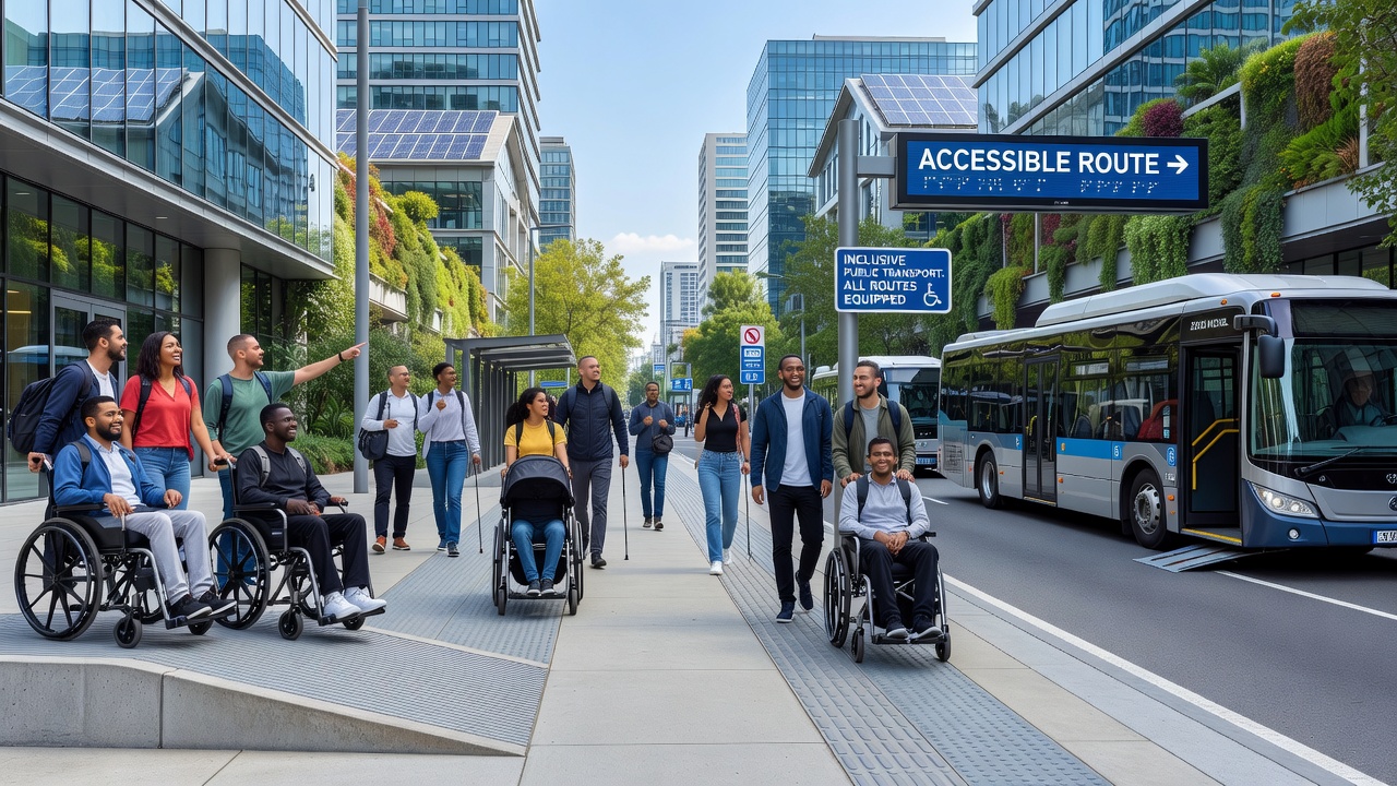
Creating accessible city guides ensures travelers with diverse needs can explore destinations confidently in 2026. These resources go beyond standard recommendations by prioritizing mobility, sensory, and cognitive accessibility. Travelers seeking inclusive planning tools benefit from guides that integrate real-time data and local insights, allowing everyone from wheelchair users to those with sensory sensitivities or cognitive differences to enjoy seamless experiences.
Standard city guides often overlook barriers like inaccessible public transport or limited adaptive activities. In contrast, accessible versions highlight ramps, quiet zones, and clear signage. This difference empowers more people to travel independently and reduces the frustration of unexpected obstacles. As global travel rebounds, the demand for such guides continues to grow, making them essential tools for tour operators, destination marketers, and individual planners alike.
Researching Mobility, Sensory, and Cognitive Needs with 2026 Data
Start by gathering current information from official sources. Use government reports and international databases updated for 2026 to understand destination-specific challenges. Focus on mobility aids, visual or hearing impairments, and cognitive considerations such as clear navigation for those with autism or dementia. Reliable data helps identify patterns, such as peak-hour crowding that disproportionately affects certain groups.
Key data sources include transportation authorities and disability rights organizations. Cross-reference findings with traveler forums moderated by accessibility experts for practical perspectives. In 2026, many cities publish annual accessibility audits that detail compliance with evolving standards. Reviewing these audits alongside user-generated content provides a balanced view. For instance, mobility needs might involve curb cuts and elevator maintenance schedules, while sensory needs cover lighting levels and noise pollution maps. Cognitive accessibility often requires simplified language in signage and digital wayfinding tools.
Evaluating Public Transport Accessibility
Assess bus, subway, and rail systems for features like low-floor vehicles, audio announcements, and elevator availability. In major cities, check real-time apps for service disruptions affecting accessibility. Reliability varies widely; some networks offer dedicated assistance hotlines, while others rely on general customer service that may not address specialized requirements promptly.
For example, compare elevator reliability rates and priority seating policies across networks. This evaluation helps travelers plan routes that minimize stress and physical barriers. In dense urban areas, consider transfer points where accessibility gaps are most common. Practical testing involves simulating journeys during different times of day to note any seasonal or event-related changes that could impact users.
Identifying Adaptive Activities and Experiences
Highlight activities adapted for different needs, such as sensory-friendly museum tours, wheelchair-accessible hiking paths, and guided experiences with sign language interpreters. Include options for cognitive support like simplified itineraries or quiet hours at attractions. These adaptations transform ordinary visits into inclusive ones that accommodate a wider audience.
- Wheelchair-friendly viewpoints and parks with accessible restrooms and pathways
- Audio-described performances at theaters and live events
- Low-stimulation environments in cultural sites with dimmed lighting options
- Adaptive sports or wellness programs designed for various mobility levels
- Virtual reality previews for attractions to reduce anxiety for cognitive travelers
Verification through direct contact with venues ensures details remain accurate as facilities update their offerings throughout 2026.
Integrating Local Accessibility Apps: Examples from Three Major Cities
Combine digital tools with guide content for seamless planning. Apps provide live updates on accessible routes and facilities, turning static guides into dynamic resources.
In New York, integrate MTA's accessibility map with apps like U.S. Department of Transportation resources for subway elevator status and real-time crowding alerts. London examples feature TfL's step-free journey planner alongside apps noting tactile paving and induction loops at major stations. Tokyo guides incorporate JR East accessibility data for Shinkansen stations, quiet train cars, and multilingual support for cognitive ease. These integrations create dynamic guides that evolve with 2026 updates and allow users to customize plans based on personal profiles.
5-Step Process for Compiling and Testing Guides
- Collect baseline data from official 2026 sources on infrastructure and regulations, including recent compliance reports and user feedback databases.
- Map accessible transport options and flag potential bottlenecks by cross-checking multiple data layers for accuracy.
- Curate a list of adaptive activities verified through local disability networks and venue audits to ensure ongoing relevance.
- Incorporate app integrations and test for mobile usability across different devices and screen readers.
- Conduct user testing with diverse participants representing mobility, sensory, and cognitive needs, then refine based on detailed feedback sessions.
Each step builds on the previous one, creating a robust framework that produces reliable, user-centered guides.
Comparing Standard and Accessible City Guide Versions
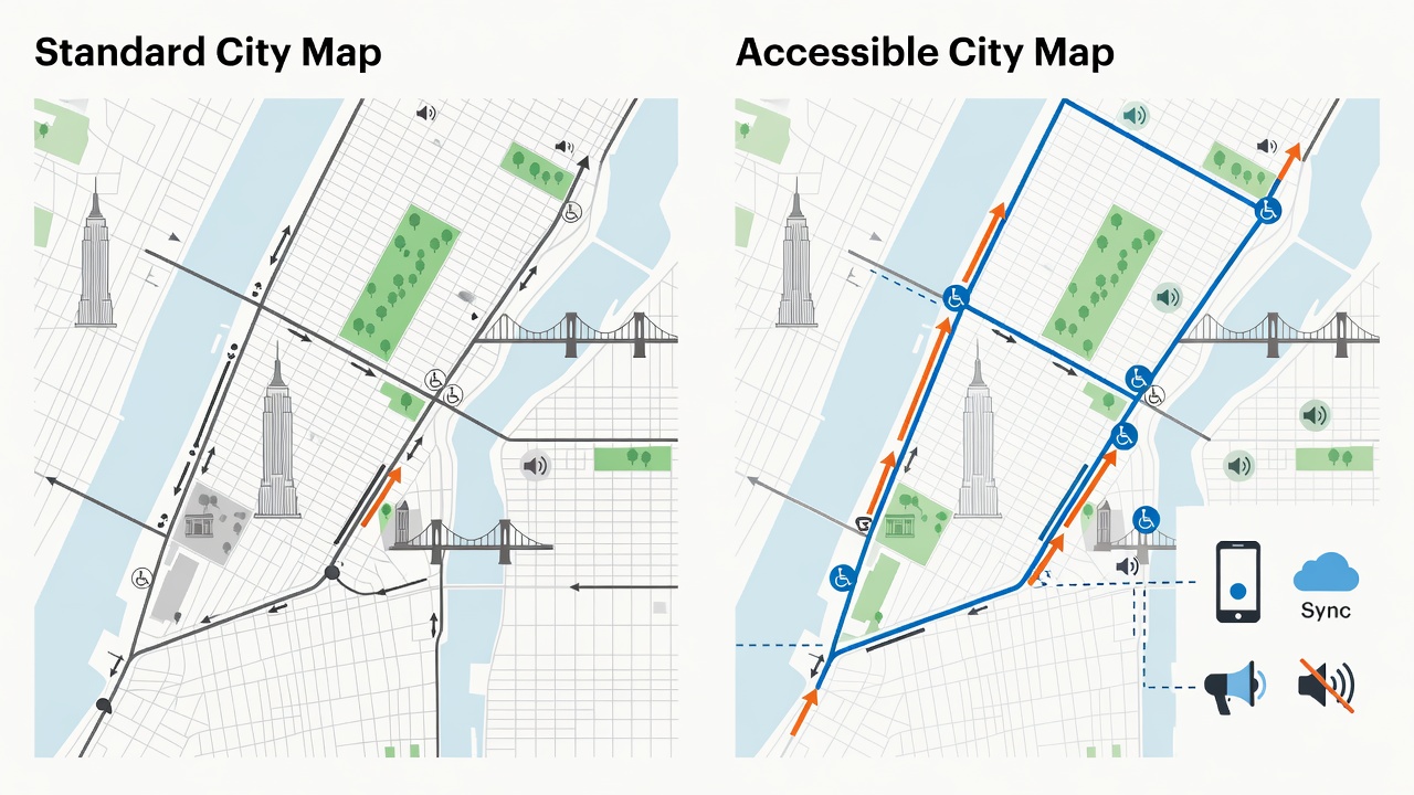
Standard guides list popular attractions without accessibility details, leading to last-minute changes or exclusions. Accessible versions include filters for needs, estimated travel times accounting for assistance, and alternative options. This results in more inclusive itineraries that reduce anxiety and increase satisfaction for all travelers. The contrast becomes especially clear when comparing navigation ease and activity participation rates between the two formats.
Common Mistakes to Avoid When Building Accessible Guides
One frequent error is relying solely on outdated information instead of refreshing data quarterly. Another involves overlooking cultural differences in accessibility expectations across international destinations. Planners should also avoid generic lists without verification and ensure all recommendations include contact details for assistance services. Testing with real users from varied backgrounds prevents assumptions that can undermine the guide's effectiveness.
FAQ: Common Barriers and 2026 Regulation Updates
What are the biggest barriers in city exploration?
Common issues include missing ramps, inconsistent signage, and unreliable transport accessibility features. Updated 2026 regulations emphasize universal design principles to address these proactively.
How do regulations evolve for inclusive travel?
New standards focus on digital accessibility and real-time information sharing. Check resources from World Health Organization for global health-related accessibility guidelines and policy frameworks.
Can existing guides be updated easily?
Yes, by adding sections on apps and testing protocols, older guides can align with current inclusive standards without full rewrites.
What role does technology play in overcoming barriers?
Apps and smart city integrations provide instant updates, but guides must still include backup offline options for areas with poor connectivity.
Conclusion
Developing accessible city guides transforms travel planning into an empowering experience. By following the outlined steps, incorporating real-world examples from major cities, and staying current with 2026 regulations, creators deliver resources that truly support inclusive travel for everyone.
Explore more expert advice in our Travel Tips.


No comments yet. Be the first!